Datasets
|
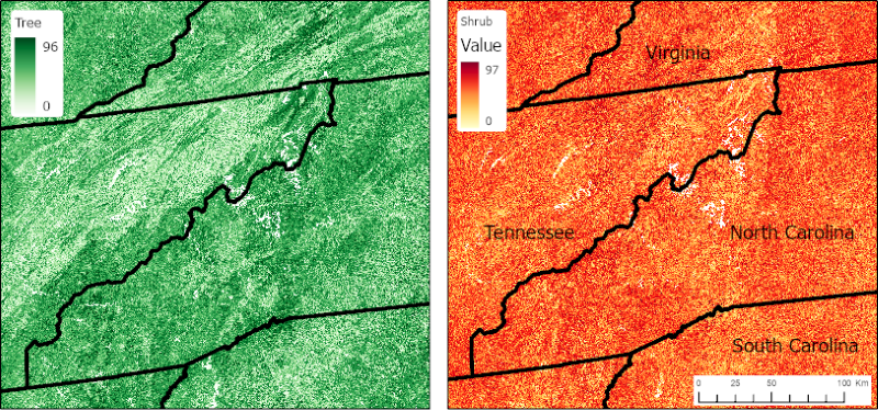
Vegetative Lifeform Cover from Landsat SR for CONUS, 1984-2018
This dataset contains estimates of percent cover of tree, shrub, herb, and other (non-vegetation) lifeform classes and uncertainties for the conterminous U.S. (CONUS). The estimates were derived using quantile regression forest models and indicate the percent of ground covered by a vertical projection of each lifeform class ranging from 0 to 100 percent. Model input data included Landsat surface reflectance (SR) data and 165 airborne LiDAR datasets covering eight of the eleven terrestrial biomes of the conterminous U.S. and Alaska. Eighty-six of the LiDAR acquisitions are part of the NASA Goddard's LiDAR, Hyperspectral, and Thermal Imager (G-LiHT) airborne imager data collection; the remaining 79 sites were acquired by the National Science Foundation's National Ecological Observatory Network Airborne Observation Platform (NEON AOP). Acquisitions were selected based on the availability of the SR data for each G-LiHT and NEON dataset. The data are annual estimates from 1984 to 2018 and were tiled (425 tiles) using the CONUS Landsat Analysis Ready Data (ARD) grid scheme. Data are provided in GeoTIFF format. |
|
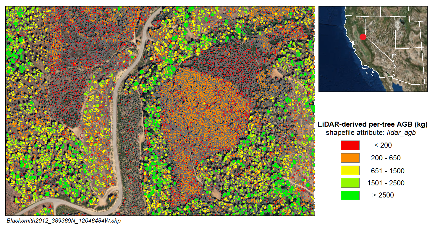
LiDAR-Derived Aboveground Biomass and Uncertainty for California Forests, 2005-2014
This dataset provides estimates of aboveground biomass and spatially explicit uncertainty from 53 airborne LiDAR surveys of locations throughout California between 2005 and 2014. Aboveground biomass was estimated by performing individual tree crown detection and applying a customized "remote sensing aware" allometric equation to these individual trees. Aboveground biomass estimates and their uncertainties for each study area are provided in per-tree and gridded format. The canopy height models used for the tree detection and biomass estimation are also provided. |
|
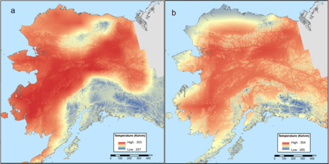
Climate Normals for Last Glacial Maximum and Modern (1975-2005), Alaska
This dataset provides two 30-year climate normal data products for conditions during the last glacial maximum (LGM; ~18,000 years ago) and a modern time period (1975-2005) for the entire state of Alaska at 60 m resolution, including: minimum, maximum, and average temperatures, total precipitation, total surface radiation, rain, snow, potential evapotranspiration (PET), actual evapotranspiration (AET), and water deficit. |
SOftware and Code
|
|
GEARS Lab GitHub Repositories
Our lab maintains a set of GitHub repos for various pieces of code that come out of our lab. |

|
R Packages
|
|
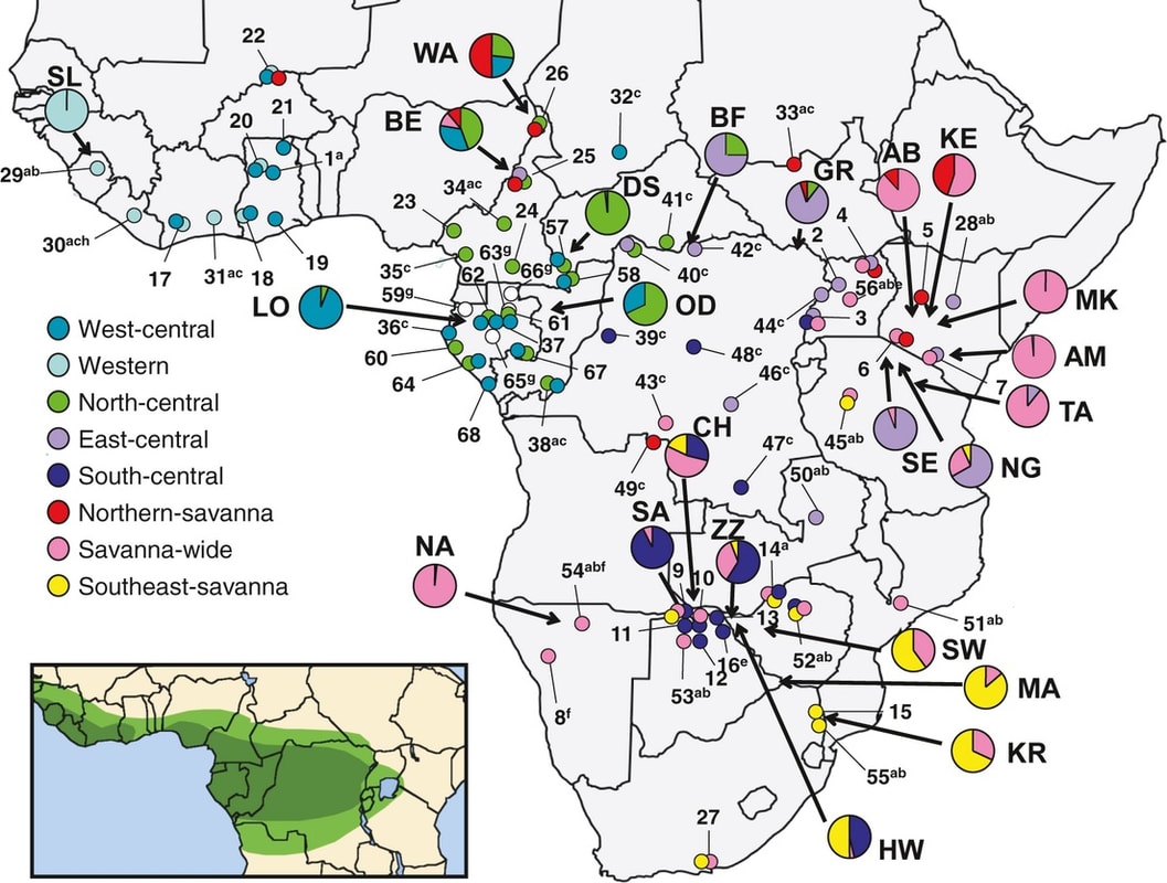
Loxodonta Localizer
Loxodonta Localizer maps the localities from which mitochondrial DNA sequences have been reported for African elephants, Loxodonta africana and L. cyclotis, using the dataset described in Ishida et al., 2013, updated with additional sequences. |